One of the practical questions that naturally arises as Local Assemblies form is:
“What area does this assembly actually serve?”
This is not a trivial question.
Clear geographical boundaries help people comprehend where they belong, how decisions are made, how responsibilities are shared – and the extent of the geographic jurisdiction of the Local Assembly.
At the same time, self-governance requires that boundaries are chosen by the people themselves, not imposed from above.
In the early stages of assembly building, council regions offer several practical advantages:
they are already clearly mapped and widely comprehended
most people know which council area they live in
council decisions directly affect daily life
concentrating people within a larger, recognisable area helps focus attention on local governance issues
it makes it easier for new State Nationals to find their assembly
councils are the front line for implementation of the Global agendas, such as those imposed by the UN and WEF
one assembly for a complete council region also means more State Nationals (the actual authorities) are concentrated on directing a single council
Importantly, this choice was strategic, not ideological. It was never intended to create a permanent structure or a top-down mandate.
Council regions are a convenient container, not a declaration of authority.
Self-governance only works if authority remains with the people at all times. That means:
no central body decides where an assembly begins or ends
no one is compelled to join a particular assembly
no boundary exists unless the people affected agree to it
An assembly that has its boundaries imposed is already undermining the very principle it exists to uphold.
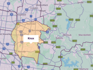
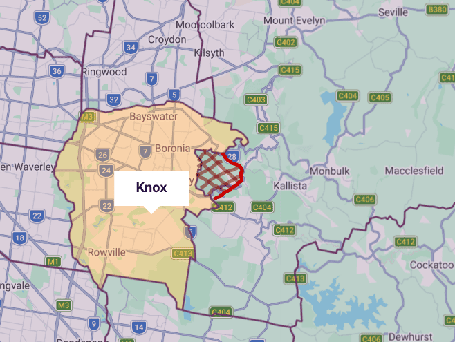
One practical way to do this is through a metes and bounds description — a plain-English explanation of where an assembly’s area begins and ends, using recognisable features such as roads, rivers, landmarks, or council lines.
This approach has several benefits:
Boundaries are not frozen in time. As populations shift, assemblies grow, or new assemblies form nearby, boundaries will be adjusted — always by the people, always transparently, and hopefully by consensus.
A common question raised by coordinators is how to respond when:
There is no single “correct” answer — and that is by design.
What matters is that these decisions are made locally, openly, and in good faith.
If you find yourselves considering annexing part of a neighbouring council region, always at the request of attendees at your Assembly, there are a few steps that should be taken:
Assemblies will need to decide how they cooperate with neighbouring assemblies when issues span multiple areas.
This is not a problem to be solved centrally, but a skill to be developed locally.
Coordination does not require control.
Cooperation does not require hierarchy.
Rather than looking for fixed rules, assemblies are encouraged to ask thoughtful questions, such as:
These are not questions to be answered once, but revisited as the assembly matures.
At its heart, this is not really about maps or lines on paper.
It is about remembering that:
When assemblies choose their own boundaries, revise them openly, and work cooperatively with others, they are not just organising space — they are practising self-governance in its most practical form.
And that is the point.

https://maps.abs.gov.au/ this website may be useful